

THE IMAGE HAS been seared into the minds of generations of Americans: George Washington standing aboard a small rowboat, resolute gaze fixed forward to the Delaware River’s banks, and destiny. At his feet, a packed crew of men representing all walks of American life propel the boat through a maelstrom of miniature icebergs. But the moment didn’t unfold as Emanuel Leutze’s painting would have you believe.
Actually, Washington probably took the ferry.
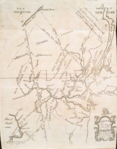
Lost in the typical history class retelling of the Continental Army’s crossing on Christmas of 1776 is that the site was chosen because it was an important local transportation hub. On the Pennsylvania side was McConkey’s Ferry and just across in New Jersey was Johnson’s Ferry. Operations like these were instrumental at a time when bridges over wide rivers were scarce.
The transportation network that the colonists, armies and founding fathers relied on during the Revolutionary War era was primitive and perilous. Yet it served as the template for the major corridors that sprung up during the rise of the railroad and the auto, ultimately driving the growth of America’s cities and towns. Highways, ports, and infrastructure we still use every day were there in spirit 250 years ago.
And in some cases, thousands of years before. When European settlers began building the early road system, they often capitalized on the existing trails developed by Native Americans, clearing and widening them to accommodate their horses and wagons. This was not a simple matter of convenience, but a recognition of the tribes’ prodigious planning.
“The American Indian was a natural engineer, and the paths which he made were at once direct and skillfully selected for their combination of all the natural advantages that were required,” Charles D. Deshler observed in an 1882 book chronicling New Jersey’s early history. “If the Indian paths crossed a stream it was either at the easiest and safest fording-place or above or below the point which was most liable to interruption from freshets; if they traversed a swamp it was at the precise spot where permanent or solid ground was to be found; if they crossed a range of hills it was by an easy grade and where the height and breadth were least formidable.”
Roads of the era were highly vulnerable to the elements and varied widely in condition. Where today their care is divided among the capable hands of local, state and federal agencies, the maintenance of many Colonial roads was no one’s responsibility. Other roads and bridges were privately owned and charged tolls to use.
“Travel during the Revolutionary era was slow and uncertain, shaped by difficult conditions and limited infrastructure,” said Thomas G. Lannon, library director at the American Revolution Institute of the Society of the Cincinnati. “Roads were often rough, muddy, and poorly marked, making journeys physically demanding and sometimes disorienting. Weather frequently compounded these challenges, with rain or snow delaying travel for days or even weeks.”
A place like Philadelphia was unique in 1776 for being known as “a paved city” because some of its core streets were made of cobblestone. Visitors to the Old City district can still walk over areas of this original stonework.
America’s First Superhighway
Recognizing the need to better link the economic centers of his colonies, King Charles II ordered the construction of a 1,300-mile road connecting Boston, Massachusetts, to Charleston, South Carolina. Work on what would become known as the King’s Highway took place from 1650 to 1735.
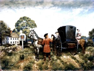
The King’s Highway was the basis for of some major American travel routes. It occupied the rough alignment of U.S. Route 1 from New England to New Jersey, where it followed modern––day U.S. Route 206 and State Route 27 to the Delaware River. In the Philadelphia area, it followed U.S. Route 13 and then rejoined Route 1 before finally tracing U.S. Route 17 from Virginia on south. While some portions of these highways sit on sections of the original King’s Highway, like many roads of the era, the route was too crooked and narrow to be adapted in full for modern travel.
The need for more reliable mail service pushed the improvement of the King’s Highway and other Colonial roads. Some stone mile markers that still stand along the Boston Post Road, a branch of the highway that connected New York City and Boston, are accompanied by signs that explain they were installed on the order of Deputy Postmaster Benjamin Franklin. Franklin was said to have traveled the Boston Post Road with an odometer he invented to measure the route for a mileage-based postage fee system he devised. Many historians dispute the story, pointing to a lack of documentation to support it.
The King’s Highway was used for troop transport throughout the war, including by Rochambeau and Washington for their pivotal march from Rhode Island to Yorktown in 1781. Today, parts of the original King’s Highway are preserved close to their original form as trails.
Rest Stops
The inns and taverns that could be found every few miles on main roads were essential for making lengthy trips possible. Often positioned at key crossroads, these businesses offered travelers a place to stop for a meal, get some sleep, and take shelter from storms.
Whether riding a horse, a wagon, or walking, a typical traveler would head as far as they could for the day, then stop for the night at one of these establishments. There they might get the latest updates on the war from fellow guests or the owners, who often lived there.
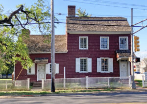
“They were places where news circulated, information was exchanged, and public announcements were made,” Lannon said. “In that sense, they functioned almost like the social media of their day. In a tavern, one could hear the latest reports, gather gossip, and observe the lives of others. They also met the practical needs of travel, providing food and lodging in a world where journeys took far longer than they do today.”
Some inns augmented their revenue with government contracts to maintain roads in their vicinity. They were also among the more regulated businesses of the day, with the crown setting prices for food, drinks and services. But equal prices did not mean equal quality.
“Does that bed have bedbugs? Is that the home of someone who is going to steal your horse at night? These are all the perils that you wouldn’t be able to see in a time when there is no Trip Advisor,” Museum of the American Revolution Senior Manager of Gallery Interpretation Tyler Putman said. “Thieving is common, highway robbery, horse theft. It’s not that this was a world of wild outlaws – it was relatively safe – but it was also a world of lack of accountability, inability to plan, freak weather events, and then you’d get somewhere when you got there.”
The Original Transit Lines
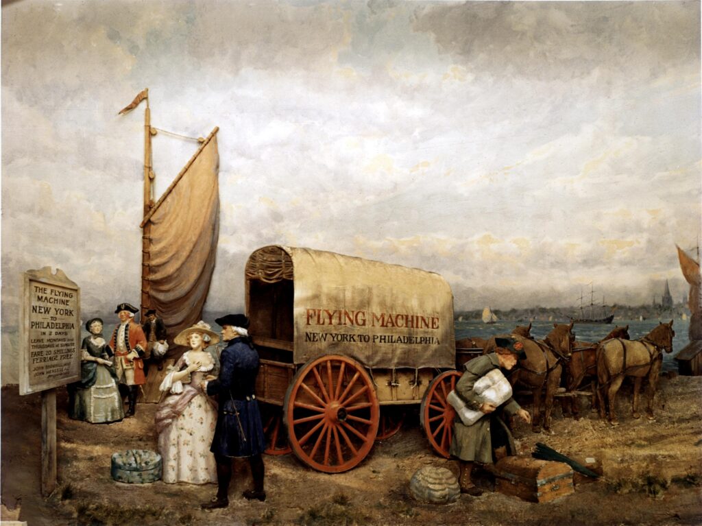
Some inns served as stations in stagecoach lines. By 1776, travelers headed between many major corridors could buy tickets to ride these wagons, which had the space to carry multiple passengers and luggage.
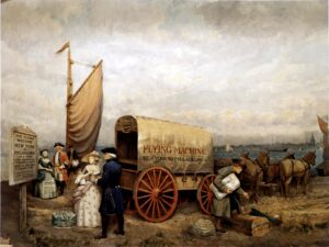
The owners of stagecoach lines had agreements in place with inn owners to allow their drivers to stop and swap exhausted horses for new ones with fresh legs, Putman said. They could then continue their trips for many miles further.
“The Flying Machine” stagecoach operation out of Philadelphia promised rides to New York City in just two days. Trips from Boston to New York might take a week. A description of one of these trips by Josiah Quincy III, an early Massachusetts political leader, made clear that travel by this mode was not always luxurious.
“We generally reached our resting place for the night, if no accident intervened, at ten o’clock and after a frugal supper went to bed with a notice that we should be called at three the next morning, which generally proved to be half past two. Then, whether it snowed or rained, the traveler must rise and make ready by the help of a horn lantern and a farthing candle, and proceed on his way over bad roads, sometimes with a driver showing no doubtful symptoms of drunkenness, which good-hearted passengers never fail to improve at every stopping place by urging upon him another glass of toddy.
Thus, we traveled eighteen miles a stage, sometimes obliged to get out and help the coachman lift the coach out of a quagmire or rut, and arrived at New York after a week’s hard traveling.”
Two If by Sea
Water was regarded as the best option for long-distance travel. Although sea and weather conditions could cause delays, the speed and comfort couldn’t be beat. The cost was affordable for regional voyages between cities like New York and Charleston. Passengers with limited means might have to work off their debts to the captain for the four- to six-week trip from London to Philadelphia.
For narrow crossings, ferry operators would extend zipline-like ropes from one side of the river to the other. Crew members could then grab the rope and pull the boat across the river. Ferry operators had larger, flat-bottom boats to cross horses, stagecoaches, and in the case of Washington’s march to Trenton, cannons. (Washington can be seen riding one of these vessels in a 2011 painting by Mort Künstler that attempted to present the moment with historical accuracy.)

Like many ferry operators of the time, the Johnson and McConkey families also ran inns at the landings where travelers could rest or, if necessary, wait until water conditions were safe for passage. Today, both buildings are preserved and open to visitors. They were likely used by Washington and his officers to coordinate the crossing during the hours it took for the 2,400 men to traverse the icy river.
Some historians refer to the era that coincided with the American Revolution as “the Little Ice Age.” The brutal winters that the Continental Army endured at Valley Forge and Morristown are legendary and made travel all the more difficult.
Joseph Plumb Martin’s memoir, a vivid window into the life of a rank-and-file soldier, shares multiple tales about the temptation for soldiers to take shortcuts by walking across waters that were not totally solid. In 1779, he was granted a furlough to visit his family in Connecticut but was held up at a river that was too ice-choked for the ferry to navigate.
“The people here told me it was dangerous crossing the river, as the ice was full of holes which were mostly covered with snow,” Martin wrote. “There was no way for me but to venture on the ice, or go five or six miles lower down the river to another ferry. I did not like the first and the second I couldn’t agree to at all.”
Today, towns with names like Gales Ferry and Harpers Ferry remind visitors of the operations that ran there in the 1700s. You might even find a nearby tavern in one of these historic areas that’s adorned with a “Washington Slept Here” sign.
“Often he stayed there not because it was his favorite house, but because it was part of the travel network,” Putman said. “So many towns exist due to their Colonial position on the hubs of rivers and roads.”
Karl Vilacoba is a freelance writer based in New Jersey.